Getting Started with
Conservation AI Network
We offer advanced AI to turn data into knowledge for land managers and researchers. Our leading-edge AI algorithms provide a baseline for the detection of wildlife. We can also provide ecological analysis and advice on study design to ensure you can extract optimal insight from the data. We aim to use these tools and methodologies to help land managers, agencies and other real-world conservationists do their job better and more efficiently.
Start GuideView FAQsQuick Start Guide for Data Owners
The Conservation AI Network currently supports the automated detection of a range of wildlife, including koalas, macropods, wild deer and wild dogs. We are continually expanding our capacity to detect new species. Please contact us to discuss any other species you may need to survey.
1
CREATE AN ACCOUNT
Register as a user by creating a profile. Follow the prompts to choose the plan that works best for you.
2
START YOUR PROJECT
Login to your personalised dashboard to create projects and manage your data and other resources.
3
UPLOAD YOUR DATA
Upload your surveys to the relevant project. Fill in the sections needed to ensure your data is analysed correctly by our team and submit.
4
DATA PROCESSING
After your project has been submitted, our team will let you know if your data is correct and ready for processing.
5
SURVEY PROCESSED
We will notify you when your survey has been processed and you can login and view your results.
Surveys
The Conservation AI Network supports the analysis of a range of data types collected from drones and camera traps. We can also provide advice on survey design to ensure that your data is collected correctly and is suitable for analysis.

DRONE SURVEYS
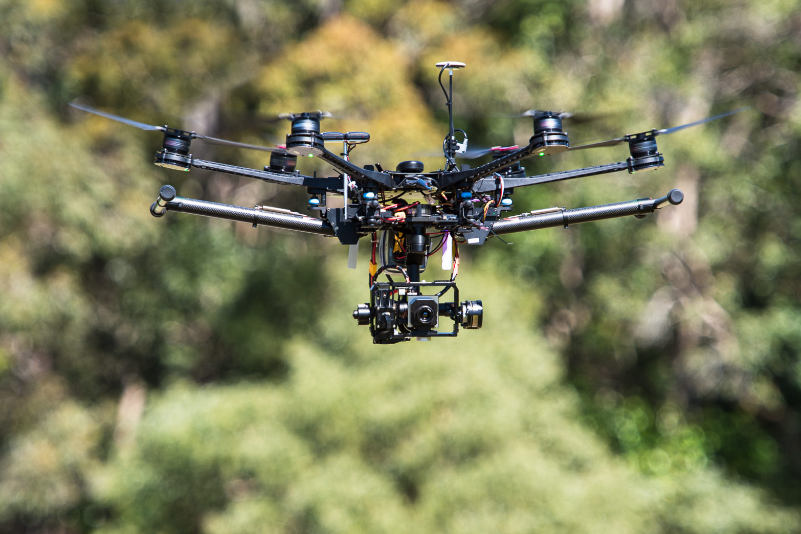
Drones (otherwise known as Unmanned Aerial Vehicles (UAVs) or Remotely Piloted Aircraft Systems (RPAS)), have become popular for ecological research. They allow data to be collected over relatively large areas, enabling efficient and accurate monitoring.

CAMERA TRAPS
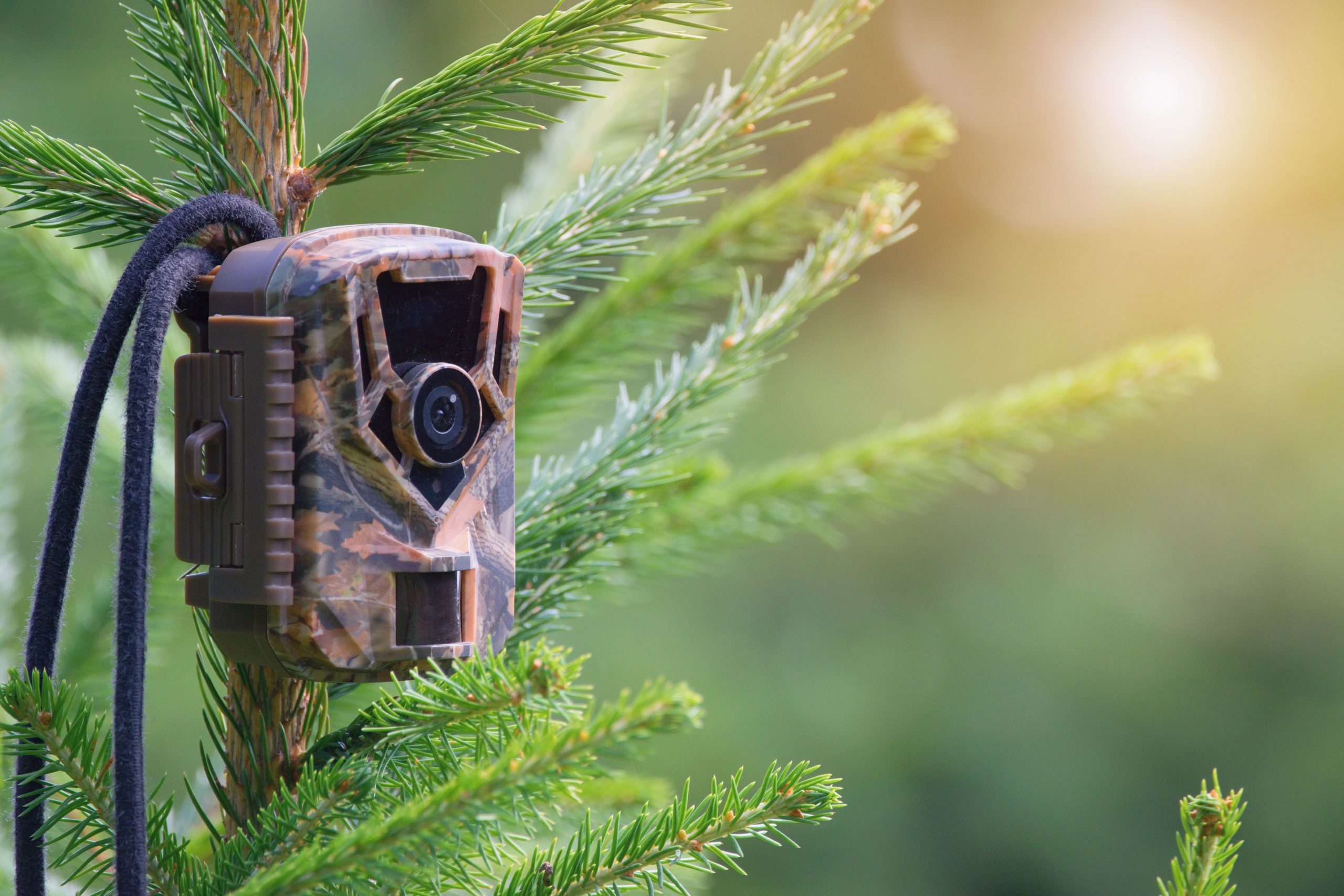
Camera traps are cameras that are automatically triggered by some event, such as animal movement. They are generally fixed within an area and then left. Once triggered, they take an image (RGB or thermal) that captures everything in the field of view.
Drone Surveys
THERMAL
Thermal sensors measure the relative temperature of objects and capture differences between them. When animals emit heat greater than the surrounding landscape, thermal sensors can be used to detect them. We use thermal sensors attached to drones to detect the heat signatures of animals in their environment. Because drones are often flown high and fast to cover large areas, we typically use machine learning (AI) algorithms to detect the animals we are looking for.
RGB
RGB (Red-Green-Blue) sensors are part of the electronic cameras that most people now use to take regular photographs. They capture visible light and produce pictures in ways that the human eye can, see, so this imagery can be useful when the colour of the animals or vegetation is important for analysis.
LIDAR
LiDAR is a sensor that uses pulsating light to measure variation of distances to a target object. It allows 3D information to be generated that reflects the underlying shape of the landscape or vegetation. The processed LiDAR data generates a dense point cloud, which effectively includes geotagged elevation points that represent the underlying landscape.
Camera Traps
Camera traps are cameras that are automatically triggered by some event, such as animal movement. They are generally fixed within an area and then left. Once triggered they take an image (RGB or thermal) that captures everything in the field of view.
Camera traps have been used in ecological research for decades. They can be deployed individually or in an array, and are usually deployed for a period of time, depending on the research question.
FAQs
Contact us
directly if you have any further questions.contact us
if you require more details.contact us
for further information.